
What is Drone Weed Spraying & Mapping?
Drone weed mapping and spraying represent a significant leap forward in weed management, offering farmers and land managers a smarter, more sustainable way to control weeds on their property.
By harnessing advanced imaging and AI-powered analytics, drones can differentiate between ‘good plants’ (crops and pastures) and weed species in real time, allowing for targeted application of herbicides. The result? Fewer chemical inputs, streamlined labour requirements, and reduced risk to both landscape and human health.
What is drone weed mapping?
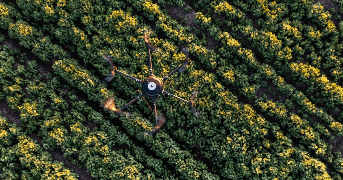
Drone weed mapping is a modern, targeted solution to the challenge of weed management in agriculture. Drones equipped with multispectral cameras and sensors fly over crops or pastures, capturing high-resolution imagery to detect the presence and density of weeds. This data is processed into a prescription map, showing exactly where weeds are located.
It's a timely innovation, with weeds estimated to cost Australian agricultural production up to $6 billion each year. $3.3 billion of that cost is borne by grain growers, who suffer an average $146/ha/yr in expenditure and yield losses.
Conventional chemical weed control typically involves the use of selective herbicides, often applied through boom sprays over entire paddocks – regardless of where the weeds are actually growing. This can lead to herbicide resistance, ecosystem and human health impacts, and potential off-target damage to surrounding crops, pastures, and landscapes.
With drone weed mapping technology, growers can:
- Use less chemical by only targeting weedy areas
- Reduce labour and equipment costs
- Minimise spray drift and its impact on local environments.
As the technology becomes more accessible, drone weed mapping is becoming a viable option for farms of all sizes.
RELATED: Single Agriculture: Single Shot UAV Weed Mapping – investment opportunity
What is drone weed spraying?
Drone weed spraying uses unmanned aerial vehicles (UAVs) to apply herbicides directly to weed-infested zones. Paired with prescription maps, drones can be programmed to fly precise paths and deliver spot-spraying treatments or full-coverage applications depending on weed density.
Advanced models use optical spraying technology, identifying and targeting weeds in real-time with high accuracy. Drone weed spraying is ideal for:
- Small or irregular paddocks
- Difficult terrain
- Areas sensitive to spray drift.
Knowing what to spray allows for informed decisions that maximise chemical efficacy and minimising spray costs resulting in cheaper, more effective weed control.
RELATED: What is precision agriculture?
RELATED: The weed-mapping drone that goes the extra mile, slashing chemical use and saving money
How does drone weed mapping and spraying work: A step-by-step breakdown
Drone weed mapping and spraying work together to improve efficiency, reduce chemical inputs, and deliver better outcomes for weed control. Here’s how the process works:
1. The drone follows a GPS-mapped flight path
Drones are programmed with a GPS-based flight path. While flying, their cameras and sensors capture multiple images per minute, identifying weed locations and densities across paddocks or fallows.
2. Data is processed into a prescription map
Captured imagery is analysed using AI-powered software to distinguish weeds from crops or soil. The data is compiled into a prescription map, indicating exactly where, and how many, weeds are present – and where spot-spraying is necessary.
3. The map is uploaded to spraying equipment
The prescription map can be loaded into:
- Boom sprays with optical spray technology for ground-based spot spraying.
- Drone sprayers fitted with real-time optical sensors for airborne precision spraying.
4. Spot spraying is carried out with precision
Using green-on-brown (in fallow) or green-on-green (in crop) AI technology, the system identifies weeds and activates spray nozzles only where needed, reducing input costs and improving accuracy.
-width-1680.png)
Frequently asked questions (FAQs) on drone weed mapping and spraying
Thinking about adopting drone weed mapping and spraying? Here are answers to common questions to help you get started.
1. What do I need to consider before adopting drone weed mapping and spraying?
While drone weed spraying is a valuable addition to a farmer’s weed management toolkit, there are a few limitations to consider:
- Limited payload: Drones can only carry a certain volume of spray, meaning larger paddocks may require multiple flyovers.
- Battery life: Flight time is constrained by battery capacity, especially when carrying liquid payloads.
- Upfront investment: High-quality drones and optical spray technology can be expensive to purchase and maintain.
- Regulatory barriers: Commercial use requires licences and compliance with aviation regulations.
2. Is a pilot required to operate my drone?
Yes. Under current Australian regulations, a pilot must be present for drone operations, who must keep the drone in visual line of sight at all times. If you're using drones commercially, you'll also need to register your drone and obtain a Remote Pilot Licence (RePL). For more information, visit the Civil Aviation Authority’s Know Your Drone portal.
3. Can I directly download the prescription map to my boom spray?
Yes, provided your spraying equipment is compatible. You'll need a compatible GPS section controller and software that supports variable rate applications. Ensuring compatibility is key to successful implementation.
4. Will weather affect weed mapping?
Yes. Wind, rain, or poor visibility can impact drone flights, reduce image quality, and affect data accuracy. It’s best to operate drones in calm, clear weather conditions.
5. How soon can I expect precision map data?
Processing time varies based on the area covered and software used, but it’s possible to generate a spray map the same day as data capture. Planning ahead allows maps to be ready when you need them.
6. How much does drone weed spraying cost?
Drone weed spraying cost varies by:
- Area sprayed
- Weed pressure
- Drone model and technology used
- Whether the service is contracted or performed in-house.
Generally, costs are offset by reduced chemical use and improved control over timing. Speak to drone providers for tailored pricing.
7. How long does drone weed mapping and spraying take? Spraying efficiency depends on the size of the paddock being treated, weed pressure, and the sophistication of the drone itself.
On average:
- Contract mapping flights for 100 hectares is around 1.5 hours.
- Data processing can be completed within a few hours, with some systems offering same-day spray maps.
- Larger drones typically spray 125 to 200 hectares per day, depending on various factors like spray type, weather, and flight speed.
Efficiency is improving as drones become faster, more autonomous, and carry larger payloads.
8. How accurate is drone weed mapping?
Modern drone systems offer high levels of accuracy:
- Image resolution can be as high as 1–2 cm per pixel, allowing clear detection of small and early-stage weeds.
- AI-powered analysis uses green-on-green or green-on-brown detection models to distinguish weeds from crops and soil.
- GPS guidance ensures precise geolocation of weed patches for targeted treatment.
Accuracy improves when flying in clear conditions and using high-quality cameras and sensors.
9. Are there any risks associated with drone weed control? As with any precision agriculture technology, there are operational and technical risks to consider:
- Weather conditions: Wind, rain, and cloud cover can impact both data capture and spraying accuracy.
- Pilot error or equipment malfunction: Navigation issues, sensor failure, or calibration errors can lead to inaccurate mapping or off-target spraying.
- Software reliability: Bugs or software compatibility issues can delay or distort outcomes.
Working with trained operators and choosing reputable systems can significantly reduce the chance of these events occurring.
-width-1680.png)
The future of weed management and control
As agricultural pressures mount, drone weed mapping and spraying offer a smarter, more sustainable approach to weed control. These technologies reduce chemical use, lower costs, and enable precision management at scale – helping farmers and land managers make more informed decisions, and get better results.